
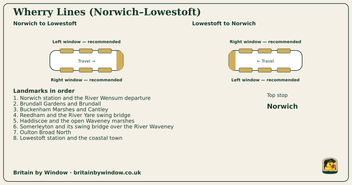
Which directions does the Wherry Lines (Norwich–Lowestoft) card show?
The card follows Norwich to Lowestoft and Lowestoft to Norwich, using the same advice as the full route guide.

 Britain by Window
Norwich → Lowestoft
Top stop: Norwich
britainbywindow.co.uk/journeys/wherry-lines-lowestoft
We like the Norwich–Lowestoft Wherry journey for its broad horizons and the way water shapes the railway. The Yare-side country leads towards Reedham, then the line crosses river and marsh landscapes before reaching Oulton Broad and Lowestoft. The swing bridges are landmarks within a working railway, not attractions where the train necessarily pauses for photographs. Keep the wider landscape in mind as you watch for them.
The Wherry name also covers routes to Great Yarmouth, so we would check the destination before boarding at Norwich. This guide follows Lowestoft through Reedham and Somerleyton. It pairs naturally with a Norwich city stay or a coastal break in Lowestoft, but the two ends offer different days out. Take the train through once to understand the landscape, then choose a single intermediate stop if the timetable allows. The flat country can look understated on a map; changing light, water and sky are much of its appeal.
A normal scheduled Greater Anglia journey through the heart of the Broads National Park. The line follows the River Yare towards Reedham, crosses the flat marsh landscape and continues over the historic Reedham and Somerleyton swing bridges before reaching Oulton Broad and the North Sea town of Lowestoft.
For a straightforward day trip, travel through to Lowestoft and choose the town centre, harbour or seafront before returning on a train checked in advance. Reedham can make an appealing riverside stop, but not every service calls at every intermediate station, so confirm both trains before leaving the route. An overnight in Norwich gives the most flexibility for pairing this branch with the Great Yarmouth Wherry route; staying in Lowestoft suits a slower coastal break. Verify any bus, boat or walking connection separately.
National Rail currently lists Norwich and Lowestoft as step-free category A, with step-free access to all platforms; both provide accessible toilets, and Norwich has a Changing Places facility. Greater Anglia's regional Class 755 trains have wheelchair spaces, companion seating, an accessible toilet, priority seating and a retractable step, but rolling-stock substitutions can occur. Access, staffing and onward paths vary at the rural intermediate stations, so check each planned stop and arrange Passenger Assist when useful.
The card follows Norwich to Lowestoft and Lowestoft to Norwich, using the same advice as the full route guide.
No. For Wherry Lines (Norwich–Lowestoft), the card is a viewing aid; use the full guide and operator links for tickets and reservations.
Open the full Wherry Lines (Norwich–Lowestoft) guide for station access, stop walks and the official planning links.