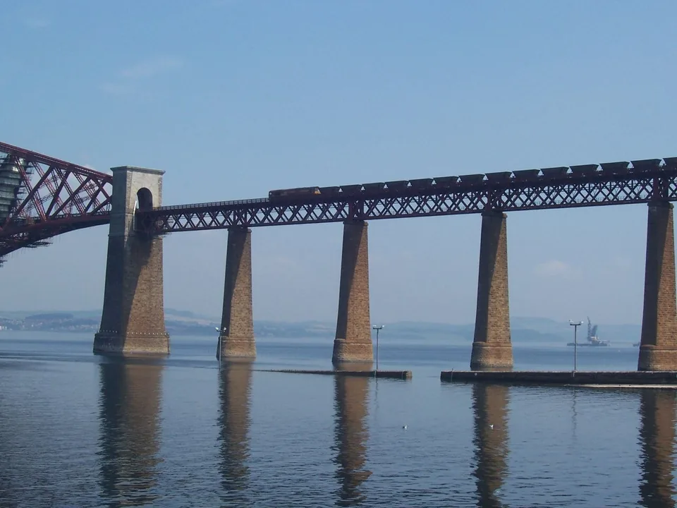
Ride between Dalmeny and North Queensferry to cross the Forth railway bridge, then choose one shore for the full view of its outline. Northbound from Edinburgh, right faces east along the Firth towards the North Sea and left faces west towards the road bridges. Southbound reverses those choices. The railway’s steel structure surrounds the train and can be seen from both sides.
ScotRail identifies the east-and-west landscapes; the window directions here follow from the train travelling north or south across them. Keep that short crossing distinct from the longer Fife coast or Aberdeen journey. A side chosen for the open Firth at the bridge is one preference within a route that continues through several other landscapes. Use the full journey guide when choosing a seat for the entire day.
On the south shore, Dalmeny station serves South Queensferry. The official trail describes a railway-side route towards the town and waterfront, with steps and sloping approaches; Jacob’s Ladder is the steeper stepped option near the Hawes Inn. On the north shore, the station route descends towards North Queensferry village. The railway pier and other named public viewpoints give the bridge a different scale from the view through a carriage window. Station access and the onward route need separate checks.
The official Forth Bridges Trail is approximately five miles overall and combines the two shores using rail and pedestrian routes. That published figure is the whole trail, not either station-to-waterfront leg. We link the map for the exact route and do not derive walking miles from its suggested minutes. The rail bridge itself has no public foot crossing: walking between the shores uses the separate Forth Road Bridge, subject to live footway conditions. Choose a short train-and-shore visit or the full trail before committing to the return connection. A photograph from land and a ride across the bridge can complement each other without requiring a long walking circuit.
Our choices and how to plan them
Ride across: east or west?
For the eastern Firth and North Sea view, choose right on the northbound crossing from Edinburgh and left southbound. For the Forth Road Bridge and Queensferry Crossing to the west, reverse that preference. Both windows show the railway bridge’s steelwork. This directional mapping is based on ScotRail’s east-and-west description of the landscape, not on a claim that a particular train seat or window can be guaranteed. Dalmeny and North Queensferry provide the short rail crossing; check that the selected service actually calls at the intended station.1
South Queensferry from Dalmeny
Use the official Dalmeny trail stop to choose the route into South Queensferry. It describes the railway-side path and steps over the former railway, with sloping approaches towards town. The steep Jacob’s Ladder steps near the Hawes Inn are a different option; the former-railway path avoids that particular staircase. Neither description establishes a wholly step-free route from every platform to every waterfront viewpoint. We retain the official directions and map without adding an unverified station-to-shore mileage. Pick the public waterfront position that suits the access needs and available return train.25
North Queensferry and the wider trail
North Queensferry station has heritage displays in its buildings, while the village route descends The Brae towards the shore. The official viewpoint list includes Railway Pier, where the railway bridge lies east and the road bridges west. For a larger outing, the approximately five-mile Forth Bridges Trail links both Queensferrys using its mapped rail, foot and cycle crossings. Read the current Forth Road Bridge footway status before relying on a pedestrian crossing, especially in adverse conditions. The overall trail length must not be mistaken for the shorter station-to-pier walk.3456
Plan a weekend
For the bridge and a wider Fife outing, compare an Edinburgh base with a stay in South Queensferry. Keep the selected station-to-accommodation route in the plan as well as the train crossing.