Ipswich to Lowestoft
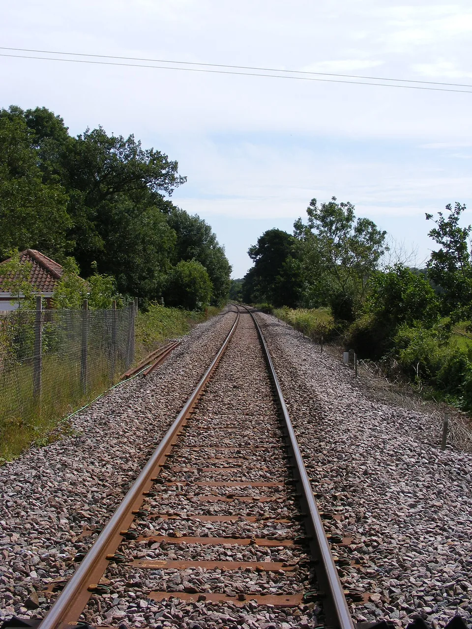
The River Deben lies to the right heading north through Woodbridge towards Melton, east of the railway. This is the riverside section; the longer inland run towards Lowestoft has fields and villages on both sides.8

England · East Suffolk, the River Deben and the southern Broads
Ipswich → Lowestoft
Tidal river, Suffolk market towns and a railway to Britain’s eastern edge
Glen Denny · CC BY-SA 2.0 · Photograph source
Some links earn us a small commission at no extra cost to you.
Before boarding
A normal scheduled Greater Anglia service through rural East Suffolk. From Ipswich the line reaches Woodbridge beside the tidal River Deben, continues through farming country and market towns including Saxmundham and Halesworth, then approaches the Broads through Beccles and Oulton Broad before finishing at Lowestoft.
Pick your window
The River Deben lies to the right heading north through Woodbridge towards Melton, east of the railway.12
The River Deben lies to the right heading north through Woodbridge towards Melton, east of the railway. This is the riverside section; the longer inland run towards Lowestoft has fields and villages on both sides.8
Sit on the left (facing forwards) for the River Deben from Melton through Woodbridge towards Ipswich; the longer inland section has views on both sides.8
Why ride it
We like the East Suffolk Line as a slow introduction to the county’s river towns and agricultural landscape. From Ipswich it reaches Woodbridge and the tidal Deben before continuing through the inland stations towards Beccles and Lowestoft. Much of the ride is away from the open coast. That makes the waterside opening near Woodbridge especially worth watching, while the fields and smaller towns give the later journey its own rhythm.
Use Woodbridge as the shorter outing and Lowestoft as the full-line destination. The station list also suggests possibilities such as Halesworth and Beccles, but a good rail day needs time in the places you choose. Pick the attraction or walk first, then see whether the departures support it. This line is a useful connection between Ipswich and the coast, with scenery woven into ordinary travel. Enjoy the continuous ride before trying a complicated chain of stops, particularly on a first visit.
Choose one main stop for a day out. Distances are one way from the station unless a circuit is stated; walking times are our estimates except where the attraction publishes one. Allow-time suggestions include time to look around.
Stop 1
Get off for the Tide Mill and the River Deben waterfront immediately beyond the railway.
From the station: about 0.2 miles (around 10 minutes’ walk)1213
How we measureCheck the next train back before leaving the station
Request stop: No — use a service shown as calling here.11
Woodbridge Tide Mill — The working tide mill has machinery and exhibits across three floors, with views onto the Deben.
Leave the station towards Tide Mill Way, cross the railway at the designated level crossing and follow the quayside towards the white mill. The measured walk is about 0.2 miles.
Access: Woodbridge station has limited step-free access. The mill describes a level approach on paved and gravel surfaces; its ground floor has ramp or level-walkway access, while the upper floors are reached by stairs.
The Tea Hut — The riverside café beside the model boating pond serves meals, cakes and drinks.
Allow time: Allow 1½–2 hours for the mill and riverside.
Some links earn us a small commission at no extra cost to you.
Stop 2
Best for a compact town-history stop close to the railway and High Street.
From the station: about 0.2 miles (around 5 minutes’ walk)1713
How we measureCheck the next train back before leaving the station
Request stop: No — use a service shown as calling here.16
Saxmundham Museum — The museum presents local artefacts, recreated shop displays and a railway ticket-office setting.
From Station Approach, walk through Market Place to High Street and the museum. The mapped station-to-museum route is about 0.2 miles, with gentle town-centre gradients.
Access: Saxmundham has step-free access using separate station entrances on either side of the level crossing. The museum’s historic premises have their own access arrangements; ask the museum before planning a visit that depends on a step-free interior.
socialbar — The High Street café and wine bar serves coffee, food and snacks near the museum.
Allow time: Allow 1–1½ hours for the museum and a café stop.
Stop 3
Leave the train for exhibitions and a café at The Cut, close to the station.
From the station: about 0.1 miles (around 5 minutes’ walk)2113
How we measureCheck the next train back before leaving the station
Request stop: No — use a service shown as calling here.20
The Cut Arts Centre — The converted maltings contains galleries and performance spaces; use its programme to choose an exhibition or event.
Follow Station Road from the station exit, then turn into New Cut for the arts centre. The measured walk is about 0.1 miles on residential streets with a modest slope.
Access: Halesworth is category B2, with access arrangements varying by platform. The Cut has lifts from the entrance to the concourse and upper floors; New Cut is residential, with no visitor parking.
The Cut Café — The arts centre café offers drinks, cakes and light lunches alongside the gallery.
Allow time: Allow 1–2 hours for an exhibition and lunch.
Stop 4
Best for the old town’s detached bell tower and views over the Waveney Valley.
From the station: about 0.5 miles (around 15 minutes’ walk)2513
How we measureCheck the next train back before leaving the station
Request stop: No — use a service shown as calling here.24
Beccles Bell Tower — The tower stands apart from St Michael’s Church; guided climbs give views across the Waveney Valley when visits are available.
From the station, walk via George Westwood Way, Market Street and New Market towards the detached bell tower on The Walk. The measured route is about 0.5 miles, with town-centre slopes.
Access: Beccles station is category B2. The approach has pavement crossings and changes of level; the tower’s upper floors are reached by stairs and are not step-free. The exterior can be enjoyed without joining a climb.
Twyfords Café — The café occupies Twyford House on Exchange Square, close to the tower.
Allow time: Allow 1½–2 hours for the tower, old town and refreshments.
Some links earn us a small commission at no extra cost to you.
Community photographs
A selected visual sequence of railway, landscape and stations along the journey.


Eight route photographs link to their original Wikimedia Commons pages for the creator, licence and reuse terms.
Start at Ipswich, on Greater Anglia’s main line from London Liverpool Street and Norwich. From Cambridge, use the operator’s Ipswich connection or the route shown in its planner. Change at Ipswich for Lowestoft via Woodbridge, Saxmundham and Halesworth.282930
Ipswich’s railway station has buses from the forecourt to the town centre and its bus interchanges. The council’s public transport page links the local operators; the rail station is separate from Tower Ramparts and Old Cattle Market bus stations.31
Ipswich station publishes station parking and accessible bays. If joining farther north, Saxmundham also has a station car park listed by Greater Anglia.619
Lowestoft is the end of this route. Return south to Ipswich or take the Wherry Lines west to Norwich for main-line connections. We treat longer community rail trails as separate walks: the partnership publishes current path alerts, including bridge closures.283233
For a straightforward day trip, ride through to Lowestoft and choose the town centre, harbour or seafront before returning on a train checked in advance. Woodbridge is the most natural stop for a shorter outing beside the River Deben; a multi-stop day needs careful timetable planning because not every train follows the same calling pattern. An overnight in Lowestoft suits a coastal break, while Ipswich is the more flexible base for combining the line with other East Anglian rail journeys. Confirm any walking, bus or attraction connection separately.3
The East Suffolk Lines Community Rail Partnership states that every station on the route has step-free access to all platforms, with lifts used for platforms 3 and 4 at Ipswich. Step-free access does not always mean level boarding or an easy route between platforms: Woodbridge, for example, uses a nearby level crossing for one platform. Class 755 trains provide wheelchair or mobility-scooter spaces, an accessible toilet and an extending step; conductors can deploy portable ramps. Check the exact stations and arrange Greater Anglia Passenger Assist when useful.2
For East Suffolk Line, choose the season around the scheduled service and the daylight needed at River Deben. Spring and summer provide long daylight for Woodbridge, station walks and Lowestoft’s coast; festival dates and school holidays can make particular services busier. Autumn suits the wooded and agricultural sections. In winter, short daylight and rural engineering work make a current timetable and disruption check especially important.3
Compare an ordinary return with the East Suffolk Lines Day Ranger if you intend to stop along the way. The community rail partnership publishes its coverage and conditions; use those details alongside the current Greater Anglia timetable. Anglia Plus may suit a broader regional day, but check its area and time restrictions before assuming it covers an early start or another operator. Flexibility is useful when you actually have trains to choose from. Separate rail tickets, walking plans and attraction admission in the budget, and keep the return departure clear before beginning a longer stop.5910
Sit on the right heading towards Lowestoft for the Deben around Woodbridge and Melton. On the journey towards Ipswich, the left is the river-facing choice there. The long inland section has views through both windows, so do not hold the camera ready only for water. Look for the change from tidal river to fields and then the approach to the Broads. At Woodbridge, photographs on foot allow more time to work with reflections and the tide. Keep station platforms and crossings clear, and stay on public routes when seeking a view beside the railway.38
Read Greater Anglia’s Class 755 information alongside the assistance advice before relying on a particular facility. The community rail accessibility guide is useful because access is not simply a yes-or-no label: routes between platforms and out into town also matter. Carry a bag you can manage during those transitions. If a wheelchair space, ramp or specific toilet is essential, confirm the arrangement for your trains and any stop-offs. A reserved or comfortable seat should take priority over the preferred river window. For a walking day, plan where you will take a proper break before returning to Ipswich or Lowestoft.24
About 1½ hours. For the East Suffolk Line journey, use Greater Anglia’s dated timetable to choose the departure, leaving separate time for the station transfer and any planned visit around Lowestoft.35
The River Deben lies to the right heading north through Woodbridge towards Melton, east of the railway. This is the riverside section; the longer inland run towards Lowestoft has fields and villages on both sides.8
Yes. Use Woodbridge for a shorter river-and-town trip or Lowestoft for the complete ride. A two-stop day is best planned from the actual departures, with time for walking between each station and the place you want to visit.13
The partnership reports step-free platform access along the route, but some platform changes use streets or crossings. Check the exact stop, onward gradients and boarding assistance, especially when combining several stations in one day.24
No. The Deben section near Woodbridge is a waterside highlight, while much of the route to Lowestoft crosses inland farming country and towns. Enjoy that variety and leave time at the destination for a separate coastal visit.13
Reach Ipswich on Greater Anglia from London Liverpool Street or Norwich, then change for Lowestoft via Woodbridge and Saxmundham. Local buses connect Ipswich’s rail station forecourt with the town centre.28293031
Read the route
Chosen for this line, its train type or the wider pleasure of slow rail travel.
by Tom Chesshyre
A contemporary, slow-travel circuit of Britain for readers who enjoy the journey as much as the destination.
View physical book (opens in a new tab)by Sherin Aminossehe
An illustrated history told through fourteen journeys—a useful companion for the wider collection.
View physical book (opens in a new tab)Further reading
Official planning
Book with the railway, or use National Rail to put your journey together.
Some links earn us a small commission at no extra cost to you.
Find places to stay in Lowestoft on Booking.com (opens in a new tab) Open Greater Anglia: East Suffolk Line Community Rail Partnership (opens in a new tab) Book your tickets (opens in a new tab)Continue exploring